The High Line - New York, NY
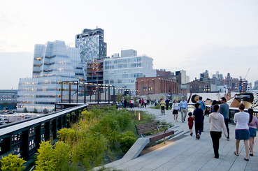
The High Line has quickly established itself as one of the most popular parks in New York City, despite the fact that is among the newest. It has also quickly become a celebrated example for other cities and projects to follow as it showcases the tremendous positive potential of parks and their impact on the surrounding community. Above all, the park turned a blighted and abandoned stretch of land into an incredible resource and attraction. It achieved this by adaptively reusing a a former elevated rail line into a publicly accessible and environmentally-friendly green space.
|
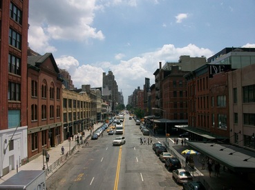
The park is the result of a recycling of a former elevated rail line that went right through the Meatpacking District and Chelsea south of Penn Station on the west side of Manhattan. From 1934 until 1980, an industrial freight train line existed on the same path on which the park now stands. It served as a connection between Midtown and Lower Manhattan for factories and warehouses. It rolled directly through dense development, and alarmingly close to buildings. It even connected directly inside of some buildings and factories, such as Chelsea market. It was viewed as a useful ploy to alleviate street traffic by allowing goods and produce to be unloaded without disturbing the flow of traffic. However, the usefulness of the line declined in the 1950s as the dominance of interstate trucking began to take hold. In 1960, the southernmost section of the line was demolished, which was about half of its length. By 1980, all train traffic ceased on the remaining section. However, the elevated line continued to exist in abandonment.
|
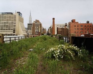
The High Line as it existed before development
|
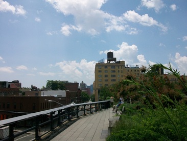
The abandoned and quickly overgrown rail line cut through a gritty area of Manhattan. The rail line served as a metaphor for an area with declining industry and a rough reputation. However, by 1999, a non-profit group called Friends of the High Line, started a campaign to preserve and renovate the line as it was being slated for demolition. They advocated for the reuse of the line for green space or park purposes. By 2004, Mayor Michael Bloomberg had thrown his support towards the project and it was on its way. By 2009, the southern section of the park was opened, and it was followed by the northern section in 2011. The resulting park is a leisurely, and at times narrow, 1.45 mile pedestrian walkway above the streets of Chelsea. Public seating has been provided throughout its length and it is interspersed with well-designed landscaping that add to the incredible views of the city and the Hudson River.
The High Line has also had an enormously positive economic development impact on its surrounding neighborhood. It has increased foot traffic to the area, as it has become a favored local and tourist destination due to its free and public nature. New businesses and residential developments have also spouted up as a result. Chelsea and the surrounding area have become home to a young and fashionable crowd, and rents and real estate prices have skyrocketed. Luxury units are now commonplace along the sides of the park, with only feet separating their respective boundaries. The success of the High Line has spurred a slate of similar plans and ideas in cities across the world for transforming abandoned elevated land into public space. The park proves that antiquated land uses can be transformed into modern public amenities that substantially improve neighborhood quality of life.
The High Line has also had an enormously positive economic development impact on its surrounding neighborhood. It has increased foot traffic to the area, as it has become a favored local and tourist destination due to its free and public nature. New businesses and residential developments have also spouted up as a result. Chelsea and the surrounding area have become home to a young and fashionable crowd, and rents and real estate prices have skyrocketed. Luxury units are now commonplace along the sides of the park, with only feet separating their respective boundaries. The success of the High Line has spurred a slate of similar plans and ideas in cities across the world for transforming abandoned elevated land into public space. The park proves that antiquated land uses can be transformed into modern public amenities that substantially improve neighborhood quality of life.
|
|
